This transit style map of Toronto waterways was submitted to Spacing Magazine as part of a call for creative maps. It was published in the Summer 2018 issue. Check out the online version below or click here to open the map directly.
Keen eyes will notice that I took some liberties in order to bring High Park and the Islands to life, and I also tossed in a couple of lost waterways, like Garrison Creek.
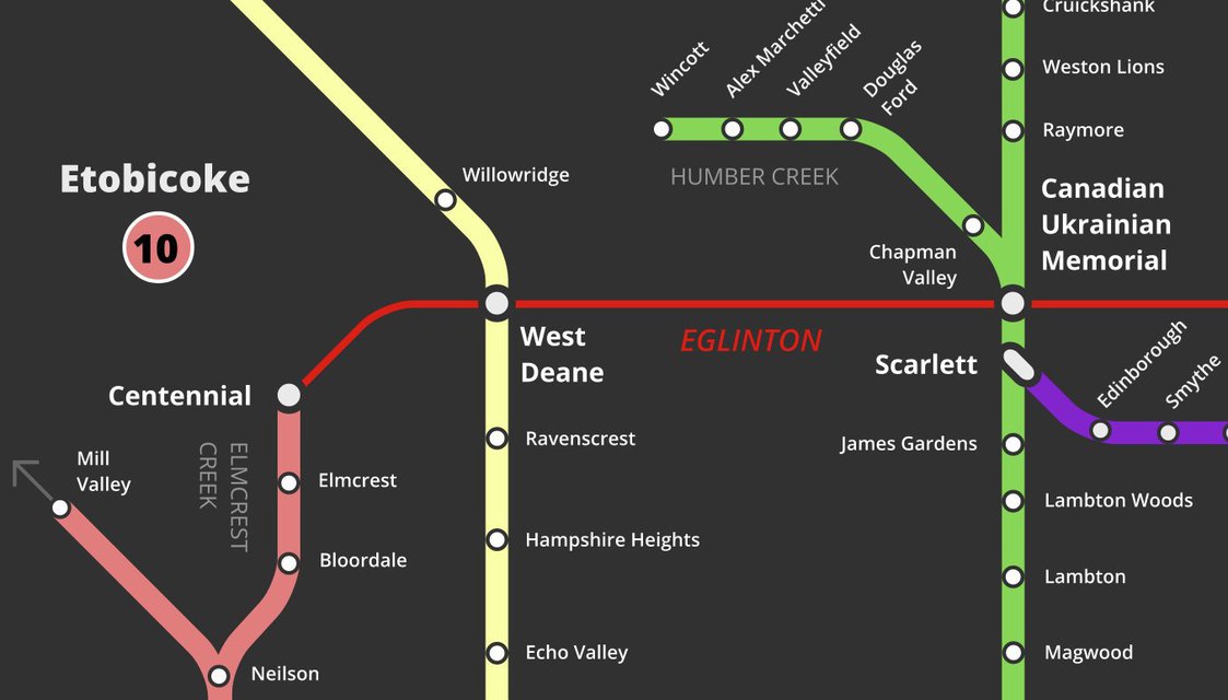
The lines imagined are:
- Humber River
- Don River
- Lake Ontario
- Rouge River
- Islands & Port Lands
- Highland Creek
- Garrison Creek
- Castle Frank Brook
- Black Creek
- Etobicoke Creek
- Taylor Creek and Massey Creek
- Mimico Creek
- Grenadier Pond
A number of streams and creeks throughout the city are shown as tributaries within these systems, but there are countless others not depicted. Not to mention the many watercourses that have been submerged under or erased from the landscape (check out Lost Rivers to learn more about some of these).
I'm still not sure which part of this map is most tantalizing: an picture of Toronto with an expansive high-order transit network, or a picture of a continuous and connected parks network.